My wife and I just returned from vacation/adventures in Leadville, Colorado (10152 ft) and surrounds – what a blast! Leadville is the ...ahem, highest incorporated city in the US and site of the Leadville 100 Mountain Bike Race and Trail Run. (Huge congrats to David Snipes for his completion of the run!) Leadville is also a great base camp for trail running, hiking, road/mountain biking adventures in the area with quick access to a great number of the fourteeners.
While we biked the start of the Leadville course around Turquoise Lake, and had several biking adventures, I’ll cut to the chase and get to the trail running races.
Saturday, August 27th Bergen Peak Trail Run
I woke up on Saturday morning to the sound of my quads and calves arguing…
Quads: Wake up! We’ve got to get to the Bergen Peak Trail Run!
Calves: ZZZZzzz….oh man, are you serious? We just did Mt Elbert (14,440 feet) yesterday, are you nuts?
Quads: I’ll go make coffee, you sit here and get psyched.
Calves: Yeesh, I’m hurting. Alright, feet let’s find my Inov-8 Roclite 285’s, woah I forgot how red they are…that’ll wake you up.
Quads: I’m back, let’s go!
Calves: I’ll sleep in the car on the way.
I eventually convinced my legs to get in the car and we drove to the appropriately named Evergreen, CO for the Bergen Peak Trail Run (10.4 mi). It was a low-key mountain running race that drew people from Boulder, Denver, and a couple from a place I just read about in Trail Runner Mag.
The fine gravel trail followed a meadow up to the base of the mountain and we ran the switchbacks up from 7220’ to 9708’, on what an east-coaster would describe as not very technical trail. Luckily, this terrain continued on the backside of the mountain, which I bombed. Having just read about Killian Jornet’s musical performance at Western States 100, I gave it a shot while downhilling. I can happily report that smiling and singing “Street where you live” from the 1956 Broadway musical My Fair Lady is a great way to approach gravity shredding. If you sing something from Andrew Lloyd Weber, however, expect to fall flat on your face.
The race was a blast, and I ended up finishing 8th overall 1:26:37/1st age group.
To check out a video of the start, get an idea of the terrain, and watch an interview where I describe the trail, check out http://www.applecorecafe.com/ and click on Evergreen, and check out the video in the top left.
Sunday, August 28th XTERRA Snow Mountain 20K
5:00a alarm sounds
Calves: You’ve got to be kidding me.
Quads: I promise we’ll take it easy today.
My quads are lying. We headed over to the Winter Park area to Snow Mountain Ranch/YMCA of the Rockies for the inaugural XTERRA Snow Mountain Ranch 20k. At 8800 ft, the Ranch is the largest Nordic center in CO, with 5200 acres to play on. The race was on the rolling hill trails and tractor roads, and in contrast to Evergreen, the course was essentially desert meadow with sweeping mountain vistas.
Every time I start a race, I hear Mark Lorenzoni’s voice in my head - “START VERY EASY, STAY DISCIPLINED.” Thanks to his three years of committed coaching before I started ultrarunning, I hear him shouting this for the first few tempting steps.
The first 1.5 miles I took it very easy, loosened up and kept the leaders in sight as I thought the course could end up being pretty quick and the field was pretty small. The leaders were not pulling away considerably, so I made a move and went for it. I took the lead after the 1.5 mi mark and just tried to stay on course and keep it steady for the first half of the race. I heard footsteps behind me at several points, but followed a lesson from my 3000m racing days (link) – never, ever look back. I threw the hammer down on the second half and fed my pace with some downhills, just relaxing and enjoying the terrain. I finished 1st overall at 1:33, and ended putting on a 3 min lead on second place who upon finishing exclaimed “You are from sea level!?”
Which sounds astonishingly like…“You are from Cville!?”
Luckily the affirmative answer covered my confusion. Thanks to it being an inaugural race, my time is the current the course record. Not too bad for a boy from sea level/Cville.
Huge thanks to Wild Bill and Cathy at the Leadville Hostel and Inn for being awesome hosts!
-Mike

Wednesday, August 31, 2011
Tuesday, August 23, 2011
Bryom Park - First Impressions

A recent comment on OUR blog by one of Patricia Ann Byrom's grandchild sounds exciting:
- It is awesome! I grew up there with the bear, mountain lion, deer, good trout fishing back then too, brookies! ENJOY it ALL!!! Patsy Park is Heaven on earth!
Following some first CAT impressions:
Christian:
The park features a couple of mostly shaded double-track trails with some significant elevation gain, my GPS showed 2615ft on our 7.5mi. We didn't see much wildlife, besides some deer ticks or chiggers I took home and discovered later. Parking lot and restroom facilities are nice. There weren't many overlooks but who needs that when doing hill repeats ;). Trails itself are fairly soft and have some rocks/roots here and there but nothing too technical really. So far I like the park for hill workouts. Due to short trails you can't really cover much distance but the park is still in development, close the the SNP which gives hope for a connector trail.
Sophie:
This park is what I call a "climbing park." If you want to get in some good vertical without having to drive south to the Priest, this is the place! As the trails get used and linked up into circuits, I can envision multi-loops that will provide perfect training for any mountain 100, Mountain Masochist, or Hellgate. It is a beautiful area and a lovely memorial, and I enjoyed knowing that generations of a family had grown up there and were happy to share it with the rest of us.
Mike:
From the very start, Byrom Park lets you know that it is not kidding around. With a climb out of the parking lot on the red trail to warm up the hamstrings, we started with an out-and-back the white trail, which will eventually form a longer loop. I counted myself lucky to be joined by my "unusual friends" Sophie, Christian, Bob, and Chris on this inaugural run, as trail runners are the only people who would readily (and happily!) cover 7.5 miles with ~2500 ft climb in more than 2 hours.
Climbing Park indeed.
We headed over to the western park of the park, where the county has painted over the bear scratching post (read: trail marker at intersection of blue and red trails), for a double loop of the blue trail. Parts of the Blue Trail loop make the climbs of the dreaded "purple trail" on the Catherine's Fatass Course look downright flat. I had to laugh as we faced what appeared to be a wall of jeep road on the trail, only to have to climb it to the "summit," which was blocked off by a enormous fallen tree and brush. It was a thrill to run on the soft side-hill down the blue trail which I had the opportunity to work on several weeks ago, which dumps into a serious downhill (that runs like the backside of Terrapin).
Overall, the trails are still raw, soft, and cover an unbelievable amount of vertical over a short distance. It is the hardest I've worked for 7 miles in a long time, and what a place to get strong at climbing, and to top it off it is only a 30-35min drive from town.
Byrom is a fantastic park and I can't wait to get back out there. Tough, beautiful, and rugged.
Bob:
Good place to get some climbing in with >10% overall grade and much steeper sections. Hopefully it will connect to some SNP trails someday. Paved parking for maybe 20 cars plus there is horse trailer parking that I guess we could use if the lot fills. The trails will only get better with use.
More info:
http://www.cvillepedia.org/mediawiki/index.php/Byrom_Park
http://www.albemarle.org/department.asp?department=parks&relpage=12998
Garmin Data:
Thursday, August 18, 2011
Team Effort: 100 on 100 Relay
This past weekend, I joined my friends Mark and Marty in Vermont for the 100 on 100 relay. Both are Captains in the US Army and are currently stationed at West Point (USMA) teaching combatives and PT, and are both fantastic runners having run for the West Point Marathon Team and South Dakota CC and T+F teams, respectively. Hence our team name...Running Commando.


Just an upfront warning, only part of this race is in trails/gravel roads. But it is an ultra (divided up into sections), and as a team we crushed it, so hopefully it will make interesting reading…
The 100 on 100 relay starts on ~3 miles of trail in Stowe, Vermont and follows the drop-dead gorgeous highway 100 for 100 miles south up and over Killington and down to Ludlow, VT. So it was a great chance to see Vermont and get some fast gravel and road miles in. angles The course really runs through all Vermont has to offer from small towns and farms, to mountains and lakes, skirting the Green Mountain National Forest.
107 teams, made up of either 6 or 3 people had a handicapped start from 5:45a-10:15a and were all slated to finish in the 8:30-11p window. We were the only ultra (3 person) team at the starting line at the 10:15a final start window, and our first runner Mark toed the line with some very fast 6-man teams (all these teams ended up going sub-7 minute pace for the 100 miles as a team, and the 6-man team winners took it with 6:22 min/mi pace).
What we didn’t realize is the challenge we would be undertaking for the first ~40 some miles of the race, as our goal pace maintaining of 7:00 min/mile pace would leave us running alone, with no one in site on our legs until we caught up to the earlier starters.
The race legs (18 of them) are divided into 5-8 mile sections, with a transition area at the end of each leg with a handoff window (we had a reflective wristband as our baton). So, upon finishing your leg you have ~15 min to recover, hydrate, fuel, and then get in the car and navigate with the other team member to the next transition area for the hand off.
Luckily, having 2 soldiers and 1 A-type nerd meant our logistics were keyed in. We had calculated times beforehand for our leg completion, kept track of our pacing by start and finish time, and had mapped out the route and driving directions on an old-fashioned road atlas. In addition, I’ll mention some other keys to success that we lucked into, as I know there are others in CAT doing relays in these next months and (hopefully) some the advice applies to ultrarunning which we frequently approach as a “team” on our group runs and races. Top 10:
Personal:
1. Think about your needs and what you need to re-cover/hydrate/fuel during the current leg. You only have a certain amount of time when you will be the center of your teammate’s attention and then its off to the next transition area so use it wisely.
2. Only focus on the current leg, and do not calculate your overall completion.
3. Metering out your effort means keeping an extremely consistent pace for your legs, so that your body "knows" only how to run at a certain pace. The pace of my legs only varied between 6:40-7:10, and my 36th mile was run at 6:30 pace. As a team, our variation was almost nil and we kept it dialed in.
4. Visualize and prepare for your legs before the race and take quick notes on the leg and your strategy so you will know what you want to do e.g. “Slow uphill 2.5 miles, then hammer the downhill.” =7:40 first two miles followed by sub-7 downhill miles to bring your average to 7.
5. Ease into each leg, you will make up the time as you loosen up again and as you near the transition area.
Team:
6. You cannot plan enough and talk about your plan for pacing, when to meet up, if a runner wants aid, where you will do this on the course, etc. Constant communication is critical.
7. Be honest and open about your current state – both mental and physical. We honestly appraised both of these frequently and it allowed us to stay on target and keyed into each other’s current state, especially as the day wore on.
8. Stay positive. All the time. If someone gets lost or has a bad leg, don’t dwell and don’t allow them to focus on it – start getting focused on the next leg.
9. Distract yourself with caring – you get one leg to recover, and then you are caring for your teammate’s needs. If you commit yourself to this, you will distract yourself and ensure your team’s success while distracting you from your cramps/pains/tightness.
10. Get excited. Energy is contagious.
We hit a really rough patch for all of us, with a very serious climbing leg (Mark), exposed lonely bit (Marty), and two bookended runs of 8 and 7 with very little rest between (me) but we rallied through the lows and "loneliness" on course, and then began passing teams that had started earlier. Our energy started rising exponentially as we passed more and more teams on our legs beginning after 3-4p and we started crushing the legs. It flew by, interrupted only by Marty and I getting leeches on our feet after a welcome soak in a lake and changing into my Dorothy costume for the Killington climb leg (photos pending).

We finished in Ludlow, Vermont at the Okemo Resort 11 hours and 50 minutes after we began, thus averaged 7:10 pace for the distance. We won the ultra division, and had a blast.
A great race, and a fantastic team effort.
-Mike
Wednesday, August 17, 2011
50K in Norway
 | |||
| My run began in the small community Snippen |
|
|
|
Today I ran about 50K, mostly in the wilderness, Nordmarka, that surrounds Oslo, Norway. I lived in Norway back in the 1990s and consider it to be my adopted home away from home. I especially love the country's beauty and the way Norwegians keep in close touch with nature. Nordmarka is an extensive wooded area with thousands of miles of trail, both for x-c skiing in the winter and hiking in the summer. The area also has a large network of gravel roads that are open to biking, horseback riding, and hiking, and to limited car traffic for those possessing keys (mainly cabin owners) that open gates at the boundaries of the areas.
I mapped out a trail loop of about 50K starting and finishing at the lake, Maridalsvannet, which isn't far from my hotel in Oslo. Nordmarka is hilly -- with heights that top out at around 2100 ft -- but it is not a trip in which you have to worry about climbing too much.
 |
| Calf-deep in myr muck |
The biggest problem with hiking/running the summer trails in Nordmarka is that the area is covered in an spongy marsh called myr, which means that almost no matter what, your feet are going to sink into a mucky, stinky mess while on the trail (I am pretty sure our word "mire" as in "mired in muck" comes from the same linguisitic root as myr. It is fitting). Norwegians often hike Nordmarka in rubber boots for this reason. I started the day thinking "no problem" because my Inov-8 295s are often wet and stinky when I run, if for no other reason than because I sweat a lot. But what I didn't take into account is the fact that we have had steady rain here in Oslo for the past several days. The three days of rain meant that most steps in the myr went ankle to calf-deep.
Feet sinking in the myr isn't so bad because the woods are really special. The tall spruce and fir trees, with their Christmas-tree looks and smells are wonderful, as is the myr flora, chock full of pretty little flowers, wild berries, and mushrooms. Often, the woods are like something out of a kid's book of fairytales. I swear I have actually seen a troll or two up there, hiding under a toadstool or wooden bridge. Nordmarka also has lots of old cabins and mountain farms that are fun to explore. Some are used today to serve food and provide lodging.
 |
| Fairy-tale woods. Blue blazes mark trails. |
My problem with the myr today was that it was slowing me down considerably. For instance, I covered only 5 miles in my first two hours on the trail and 8 miles in three hours. At that rate, I would be doing a 12-hour 50K -- too slow even for me! So at about mile 9, I opted for taking gravel roads for awhile to catch up on time.
 |
| Myr flora |
Not only are the gravel roads easy to run on -- they are more packed dirt than gravel - they also stay pretty flat, so you can make up a lot of time traveling the roads instead of trail. So I pushed on by road to my turnaround point, a lodge that serves food called Kikutstua.
 |
| Gravel road - At last! |
I know the Kikutstua lodge well. I skied to it with friends several times when I lived here in Norway and it was part of a run I did last year. It is a popular destination spot, particularly in the winter, as you get there by crossing a long frozen lake. It has a nice cafe and even rooms if you want to sleep over. Within a couple of miles of the lodge, all I could think about was getting there to buy a Fanta orange soda, some chocolate, and maybe a cup of coffee.
 |
| Kikutstua |
Kikutstua appeared at about mile 18. But boy, was I sorely dissapointed! You see, I brought only my Visa debit card to pay for my food. Electronic terminals are even more popular here than in the U.S. and so I thought I would be fine. But no, the dude working at the cafe at Kikutstua insisted that his terminal only took Norwegian cards, not the card of some dumb foreigner. I was pissed, because (a) I didn't believe him, and (b) he was being such a jerk (most Norwegians are very nice to foreigners, by the way).
No matter though, I had plenty of gels with me. So I filled up my hydration pack, gave the dude the finger, and booked out of there fast without my Fanta, chocolate or coffee.
Back on the road out of Kikutstua, I had one long hill to climb, and then everything was literally downhill back to town . During my trip down, I veered back onto a trail I knew called Helvete, which means "hell" in Norwegian. Despite its name, Helvete is a very nice trail that climbs steeply up the side of a ravine and then drops back down again. Most of the trail is myr-free.
 |
| Helvete, passing near power lines |
But Helvete only lasts a couple of miles, and then it was back on to gravel road the rest of the way down to the forest-road gate. On the trip down, I passed lots of cyclists out for the day, but no other runners. I arrived at the gate -- mile 28 -- about 7 1/2 hours after I started. From the gate, it was another 4 miles of running on paved road and biking trails back to my hotel.
 |
| Gate at end of forest road |
Overall, it was a fun day out in Nordmarka and decent time on my feet for MMTR training.
Note: I took some liberties with my story telling: 1) I have never actually seen trolls in the woods in Norway, and (2) I never really gave that guy at Kikutstua the finger.
More photos from my trip are available here
Note: I took some liberties with my story telling: 1) I have never actually seen trolls in the woods in Norway, and (2) I never really gave that guy at Kikutstua the finger.
More photos from my trip are available here
Monday, August 15, 2011
Martha Moats Baker Memorial 50k
 This past Saturday some CATs (Bob, Drew, Sophie and me) ran another free event put up by Dennis Herr from VHTRC. As always, VHTRC events are guaranteed fun and you can experience the dedication those folks put into their events.
  |
| Joe Schramka running through the clouds |
Drew and I carpooled to "in-the-middle-of-nowhere"-Stokesville, VA (the Harrsionburg side of the Massanutten. The complete course is about 35 mi long and provides a decent elevation gain of 8400 ft. Thanks to the Waypoints Drew put in his GPS, we made it to the parking lot at 6.20am, and got one of the last empty spaces. After gearing up and packing map (and yes, Thanks Snipes for giving us an extra map) & turnsheet in the hydration pack we (25-30 runners) came together for a group picture. Many of them took the shorter, 26/28mi option of the course. In a short pre-race briefing, Dennis pointed out that we shouldn't cross the "flower" line, I thought this was a little odd, but given that we trail runners usually are nature conscious it made sense, kind of. (It took me about 20some miles to realize that a flower-line was a flour-line as in course marking. Go figure.). In perfect weather (in the 60/70s) we took off.
The plan was to run with Drew and go for the full distance. Coming back from a beach vacation (and 34ft elev gain runs) two days prior, I figured I need to get in some extra climb. We ran with Sophie, Bob and a few others for the first miles. Sophie gave us some tips along the course of easy to miss turns that served us well in the end (and yes, also arrows put down by David Snipes!). I separated from the group and ran in front with Joe Schramka, one of the WUS'ses (Woodley Ultra Society). I enjoyed getting to know him and talk about running. Drew caught up with us a few miles later and we refueled at the first aid station at Reddish Knob:
 | ||
| 1st Aid Station at Reddish Knob (13mi) |
We kept checking the turn sheet as we continued on the course as some turns were not obvious. The vegetation of parts of the course seemed like in California, pine trees and lots of grass - a nice change compared to the AT & Blue Ridge. Quite a few times we had to bushwhack as the bushes were covering the trail. We ran at a good pace and didn't think anybody would catch up soon, shortly after - out-of-nowhere, Eva Pastalkova, flew by with a quick "Hi, guys!". Even though she started 34mins late, she passed everybody! Crazy!
After the second aid station (21mi) we hit a short but nice cooling rain shower. Sweet! Some more uneventful ups and downs until we stopped at the last aid station, Grooms Ridge (27mi).
 | |
| If I had known that the final "brutal climb" meant brutal climb I might have not smiled here. |
The final stretch (that many skipped for a reason) was about 4mi up and 4mi down. At this point my legs were quite tired from going out fast on the downhills earlier and I noticed that I didn't keep up with my nutrition too well - I felt a little empty. Also the weather turned to the sunny side and let the temps rise to 85-90F?! Yay! I think it took us about 2hrs for the 4mi up and 1 hour down. I let Drew take off and ran/walked the rest.
The finish party was great (as VHTRC-usual), lots of food and drinks and good company. We were surprised to hear that Eva didn't make it to the finish yet... as it turned out she had run 10-bonus-miles. Drew (7:50hrs) and I (8:01hrs) made the first two places (out of 6 that did the whole course). Good times!
 |
| Rewarding views on the final miles.. |
 |
| Party at the finish. |
Thanks to Dennis Herr and all the wonderful volunteers who made this event possible. It was a great day, beautiful course, and a fantastic race.
Link to the event: http://www.vhtrc.org/events/mmb.htmPhotos by Christian:
Photos by Quattro:
http://www.flickr.com/photos/qhubbard/sets/72157627318827081/
Photos by Doug Sullivan:
Wednesday, August 10, 2011
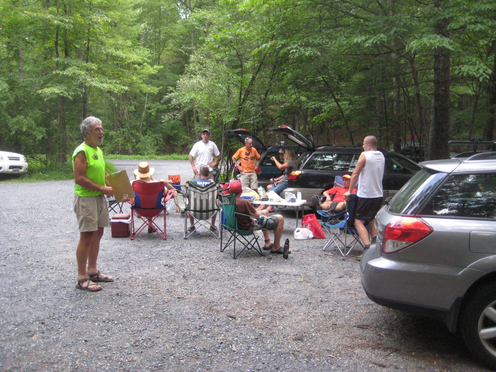
Byrom Park Inaugural Run Sunday, August 21st
I've gotten final word that Byrom Park will officially open Friday, August 19th!
If you are interested, I'll be "hosting" an inaugural run out there Sunday, August 21st at 7a.
There will be a map posted in the kiosk and there *should* be 8.5”x11” maps at the kiosk as well. There will be a 5-6 mi loop and a couple of 1-2 mile long "dead ends" that should hopefully whet your appetite for what is to come. We can run every bit of it and then if some of you would like to double the loop, I'd be game. Expect a run (with climbing) of about 8-12 miles, though you could always triple the loop for 18-20 mile run.
As usual, you will be responsible for your hyrdation (Bring a handheld or two) and navigation (grab a map at the start).
I have put directions at the end of this email, and it should take about 45 minutes driving from Greenberry's if y'all would like to meet up at 6:10a there to carpool. I'd love for someone to bring an accurate GPS as well so we can figure out how close we can get to SNP/AT.
I hope you will be able to join me, and I'm looking forward to it!
-Mike
Directions to Byrom:
Byrom Forest Preserve Park
6610 Blackwells Hollow Road
Crozet, VA 22932
Directions from town (takes approximately 45 minutes):
1. Follow Garth Road to the Piedmont Store
2. Go around the curve to the right onto Rt. 810 (do not go straight up to Sugar Hollow)
3. Follow Rt. 810 for 7.8 miles and parking area is on the left
Tuesday, August 9, 2011
CAT blog gets recognition in Charlottesville's Daily Progress
Mark Lorenzoni, owner of Ragged Mountain Running Shop and running coach extraordinaire, also writes a weekly running column in Charlottesville's Daily Progress. This week, Mark highlighted the recent significant achievements by area trail runners, Jennifer Pharr-Davis, who lives in North Carolina and just blew away the AT thru-hike record (a 1994 record held previously by a man), and Andy Jones-Wilkins, the new head of Tandem Friends School, who finished in the top 10 at this year's Western States 100-mile race (It is Andy's 8th top-10 finish at Westerns!).
Mark finished off his column by pointing to our blog and noting that Sophie Speidel, among other talented runners, are part of the exciting CAT scene. Thanks for the support Mark!
You can find Mark's column here.
Coverage of Pharr-Davis' accomplishments can be found here and here, among other places. Catch a pre-Western's interview of Jones-Wilkins by Byron Powell here and a post-race interview of Powell by Jones-Wilkins here.
Subscribe to:
Posts (Atom)