Showing posts with label group run. Show all posts

Thursday, July 3, 2014

CATass 50k

While many of our friends will be running the VT100 on July 19, those of us left behind can have our own fun at the CATAss 50k. Created as a training run for Western States by our friend Andy Jones-Wilkins, the CATAss is a true Fat Ass in that there is no fee, no T shirts, no wimps and no whining. There will be water and heckling at miles 5, 12 ( a spring), 19, and 25, and the requisite post-run story telling, eating, and drinking.

The course combines the New Year Day Rendevous Run with the Harry Landers Special. First, runners will run to Blackrock from Sugar Hollow:

http://www.vhtrc.org/trails/sugar-hollow/sugar-hollow-blackrock

Then they will head north from Blackrock on the AT and run the Doyle's River and Jones Falls Loop CCW:

http://www.shenandoahviews.com/Waterfalls/DoylesRiverFalls/loft_mountain_jones-doyles.pdf

They will return to Blackrock on the AT and continue south to Turk Branch Trail and the finish at Sugar Hollow:

http://www.vhtrc.org/trails/sugar-hollow/harry-landers-special

More details will be forthcoming. If you are looking for a solid, hot, hilly, beautiful training run for your fall ultras, come join us at the CATAss 50k.

Monday, January 28, 2013

Sunday 18.5er & Updated RT Turnsheet

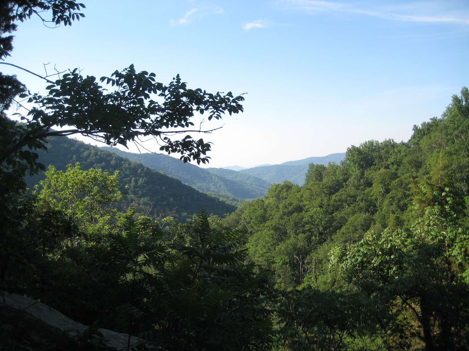
This past Sunday we did another group training run of the whole Rivanna Trail. Following the post-run-report from organizer Neal:


This morning's loop was a huge success.  11 runners braved the cold temperatures at Riverview at 7am and cheerfully made their way around town on the Rivanna Trail in the counter clockwise direction.  Near the Park (after passing Barracks area) we linked up with four other runners who had started the loop earlier than 7am.  So there was 15 of us in total!  There were a few planned early drops but most everyone finished and finished strong.  The fun continued post-run at Beer Run.  There happened to be a New Belgium rep dinning with his daughters behind us and, thanks to his brief conversation with Jason, graciously offered our group a complimentary round of their new Imperial Coffee Stout, which many of us happily accepted- including yours truly.  It was tasty.

Also, the footing on the trails this morning was the best I have ever experienced on the RT.  Zero mud.  Everything was frozen solid and super tacky.  Three cheers for those low temps!

Having run the loop twice in two weeks with several people  I truly think there are going to be some real surprises time wise come a month from now.  Personally, I won't be that surprised.  There are some strong runners in this group.  But I do think several people are going to surprise themselves.  


Nick created a fantastic turn sheet of the whole loop, so that folks wont have an excuse to get lost in the future


This is a bit late for folks hoping for some descriptions this morning, but hopefully it'll still be useful to somebody some day. Also, hopefully, I'll work to incorporate useful bits into the RTF's map - so if you've got comments, questions, suggestions, corrections please let me know. Please don't get mad at me if you get lost while trying to follow these directions. And these are just my notes, not anything official from the RTF.

I'll start at Riverview, and generally go around counter-clockwise, finishing back up at Riverview.

Riverview - River Rd: At Riverview Park, there are two trailheads out of the parking lot, both heading out on paved footpaths. One would be if you continue straight, the way you came in to the parking lot, the other goes off to the right, heading toward the playground area and Rivanna River. You can take either, they both meet up after a short while, and there are some un-paved cut-throughs between them. The trail will be a paved walkway for a few miles, and basically follows the river (which'll be on your right), passing under route 250 at one point. Eventually you'll pop out at a field with some soccer goals set up. You can continue following the trail, or you'll see a parking lot off to your left - you can head up there and turn right on the road that's there (River Rd). If you stay on the trail, it'll go just a short bit through an area with some small trees, close to the river bank, and then there will be signs pointing you to the left. That trail heads up a hill, then runs along a fence at a VFW building until you get to the road (River, same road), on which you'll turn right.

River and Locust: Head up the hill on River, and at the stop sign at the end of River (at the top of the hill), turn right on Locust Ave. That'll head downhill a little bit, and come to a T-intersection. Turn left at the intersection, onto Locust Lane, and then take your first little road to your right, Megan Ct. At the end of that short little road is a sign for the RTF, on the right.

Locust - Holmes: From there, the trail heads downhill for a short bit, to get down to Meadow Creek. Once you get there, you'll continue along with the creek on your right, eventually popping out of the woods into a clearing with the creek on your right but curving left in front of you, and houses up the hill on your left. Follow that clearing, staying between the houses and the creek, with a few hops across some drainage areas as you go. In this section, keep to the right side of the clearing. Shortly before getting to Holmes (the first and only road crossing), the trail and clearing generally veer right, and once they do you'll be able to see Holmes ahead of you.

Holmes - Melbourne: After crossing Holmes Ave, pick up the trail in the gap in the guardrail. This trail follows the Meadow Creek (on your right), with a cleared strip of land on our left. The single track eventually dumps out onto the cleared stretch, and you continue on, keeping the creek on your right. Once the creek turns left, the clearing ends and you go left into the woods, back on single track. This continues for a short bit, eventually crossing under Park St at its intersection with Melbourne. Just after crossing under the road, the single track is closed, and you must go left, up to Melbourne Rd.

Melbourne - Meadowcreek Parkway: Once you get to Melbourne road, looking left you'll see the intersection with Park. However, you want to go the other way, heading instead to the light at the Meadowcreek Parkway. You'll make a right at the parkway to get on the paved footpath following the parkway.

[[McIntire spur: Instead of turning right at the parkway, you can continue straight on Melbourne. You'll go up a hill, and over a bridge across the train tracks. Just after that bridge, there's a Rivanna Trail sign on your left, leading down some stairs, and you'll see Charlottesville High School in front of you (with the baseball diamond the closest thing to you). If you head down those stairs, and stay generally left, there's a patch of trees between the railway and the baseball diamond. You can either hop on a short bit of singletrack in that clump of trees (which quickly comes back out into the grass), or just stay between the trees and the baseball field on a trail that heads down the hill. This trail shortly crosses into the woods, followed at the bottom of the hill by a creek crossing (where there's concrete pillars, so you wouldn't expect your feet to get wet). Continuing to follow this singletrack, you'll eventually get to a spilt where you can go left past a bench, or stay right. If you go left, you'll go up slightly to a paved footpath, which you can take left to get into McIntire park, or take right to cross the creek and get to Charlottesville High (or stay straight to reconnect with the singletrack). If, instead, you stay right on the singletrack, you'll cross under this bridge, and when the two trails reconnect you go right, and cross another creek (where you might, actually, get your feet wet). After that crossing, stay right for the singletrack (or go left, and shortly come to the new paved trail, which will reconnect with the single track after a short distance), and continue following the singletrack through the woods. You'll cross a few small wooden bridges, and eventually get to a cement pad, right near where the paved trail comes back in. Continue on, and the trail will narrow slightly, and head up a little hill, with 250 above you on the left. This trail comes out where 250 and Meadowbrook Heights intersect, with the "Whale Tail" installation of the Art In Place in the clearing. If you continue on, following 250 (with it on your left), you could cross Hydraulic Rd, and then pick up the Rivanna Trail again there.]]

Meadowcreek Parkway - Railroad: Continue on the paved pathway, with an eye to your right to hop back on singletrack. If you end up going uphill on the paved pathway, you've gone too far (but the two meet up again, so it's ok). The trail here stays basically along the Meadow Creek (on your right), and there's a short steep hill to get you back up to the paved pathway when the two meet again. The singletrack and paved path meet at a large bridge for the parkway (above the trail) with a smaller footbridge for the paved path off to the right. If you were to go right on the paved path, it would wind its way uphill, eventually ending at the intersection of the Parkway with Rio Rd. However, to continue on the Rivanna Trail you do not want to do this. Unfortunately, at the intersection of the paved path with the singletrack, under the bridge for the parkway, what you do want to do is somehow find your way to the other side of the railroad tracks. Standing on the paved path, with your back to the singletrack, you'll be looking at the bridge for the parkway. Just past that is the train tracks, at the top of a quick hill, and the creek is on your right. The creek passes under the train tracks through a culvert, and generally the water is not more than 2-3 inches deep, and the creak bed is even. Alternatively, steep trail can be found which goes up the steep embankment to the railroad tracks and back down the other side. Unfortunately, neither of these options is condoned.

Railroad - Brandywine: If you should happen to find yourself on the west side of the railroad, north of the creek (looking away from the railroad, the creek is on your left), the trail follows another cleared strip of land, which has a few bushes and things planted. After a little wooden footbridge (the second), you find yourself on the creek bank of the newly completed creek restoration project. The trail is not well defined here, and the footing is a bit uneven and over a netting, but you just want to follow the creek. It'll cross a paved pathway, running perpendicular to the creek at one point - going right would take you to Greenbrier Dr, going left would take you across the creek and to Jamestown Dr (where you could follow brown RTF blazes back to Charlottesville High, if you wanted (quickly: Jamestown becomes Lester Dr, which T's at Kenwood. Turn right on Kenwood, follow it around to the right, up a hill, then turn left on Melbourne Rd)). However, to follow the RTF loop, continue straight, with the creek on your left. Before long, you'll get to the three-way intersection of Brandywine Dr (going left, or straight-right-ish) and Greenbrier Dr (going right, sorta back the way you just came).

Brandywine - Hydraulic: At the Brandywine/Greenbrier intersection, the trail continues in the cleared strip of land, sort of like where Greenbrier Rd would continue, if it didn't end at that intersection, with the creek still on your left. A few hundred yards down that strip, look for a rock-hop creek crossing on your left, which has a cable strung up between the trees to aid your balance. You want to cross the creek here, and then veer right (so that the creek is now on your right). The trail moves a little bit away from the creek at this point, with woods on both sides of you (and houses up your hill on the left). There are no real trail intersections here, although some re-routing as the creek restoration project was in progress has provided some options at one point. As long as you're continuing on with the creek on your right, houses up the hill on your left (and aren't getting in people's yards), you're still on the right track. Just before the trail gets to Hydraulic, you can either go left, and up a quick hill to get to the road, or stay right, pass over a short rocky section, and then walk through a tunnel underneath Hydraulic Rd.

Hydraulic - Morton: After crossing under Hydraulic Rd, continue on the singletrack (creek on your right), coming to a set of stairs which take you up to near the intersection of Hydraulic Rd and 250. At the top of the stairs, go right, following the concrete sidewalk, until just after crossing the bridge, where the trail turns left and heads down to the creek where it passes under 250. Underneath 250, you'll be walking on some cement blocks which are starting to deteriorate, so watch your footing. After coming out of the tunnel, the primary (green) trail basically follows the creek (now on your left), eventually coming to the RTF tool shed (which will be on your right) near the Meadowcreek gardens. An alternate (brown) trail will branch off to your right, but reconnects with the main trail before the RTF shed. The trail is close to the creek after the shed, and parallels a gravel driveway. The two come together at Morton Dr.

Morton - Barracks: Turn right on Morton, and continue to the light at Emmet St (the intersection where Bodo's Bagels is). Cross Emmet, and continue straight on Earheart (Cavalier Diner on your left, Asian market on your right). Near the end of that little road you'll see a sign on your left for the RTF, at a wooden bridge. Crossing the bridge, the trail continues for a few yards and then crosses a chain link fence at a gate. The gate is rarely locked (though it is, occasionally). Once in the fenced area (if the gate wasn't locked), turn right and follow the gravel path. While you're still in the boundary defined by the chain link fence, there will be a right hand turn leading you out of the fenced in area, which you should take. Just after coming out of the fenced area, you'll cross a little wooden bridge, and will see a road ahead of you (or to your right, depending on how quickly you look for it after you get off the bridge). Go out to the road (Cedars Ct), turn left, and follow it to its intersection with Barracks Rd. The trail continue straight across Barracks Rd from this intersection.

Barracks - Leonard Sandridge: At the trail head off Barracks, you'll go up a short flight of stone stairs, and then the trail goes to the right. It veers left shortly after that, then right across a wooden bridge (which can be fairly slick in wet conditions), and left again. It then follows the creek (on your left), for a little while. When you get to another wooden bridge (with "monkey bars" overhead), you can cross it and go left to hop off the trail at UVA's "The Park" at North Grounds. Alternatively, you can cross the bridge and go right to follow a spur trail, which connects with the main trail again in about a tenth of a mile. The main trail, however, doesn't cross this bridge (the monkey bars bridge), and simply continues on with the creek on your left. After curving to the right, it then does cross a different wooden bridge, this one with some flower pots built in. The trail then continues on a sort of gravel access road, eventually going up a short hill at a land bridge over the creek. The primary trail, at this point, continues straight. [[However, you could cross the land bridge. If you did, you'd come to the intersection with the trail from the monkey bar bridge (coming in from the left), and would also have the option of going right, to follow the trail up the hill. This trail is marked with green RTF blazes, and is parallel to the primary trail, which stays lower, and closer to the creek. If you decide to take this trail up the hill, the trail is easy to follow, and staying right at all the trail intersections will keep you on track.]] The primary trail and the alternate (hilly) route meet back up after a few tenths of a mile, and then continue on until a short steep climb up to Leonard Sandridge Rd.

Leonard Sandridge - Old Ivy: Cross Leonard Sandridge, and cross the wooden footbridge to continue on the trail. There are no trail intersections in this next section to worry about, just continue on until you get to the next road crossing, which is Old Ivy Rd. The final hill before Old Ivy can get quite muddy.

Old Ivy Rd - Ivy Rd: Unfortunately, there's another train track in the way of what you want to do to follow the trail. If you were to cross Old Ivy and then turn into the second driveway (for Ivy Stacks, not UVAs Printing and Copying Services), and then follow that driveway straight/right, then just before it went left behind the building, you'd be able to look across the train tracks at the light which is the intersection of Ivy Rd and 29. Just next to the fire station, across Ivy from where you're standing, is where the trail picks up. You might even see a little trail leading you across the tracks and down to the road. The shortest road detour at this point is to turn right on Old Ivy, cross over 29, left at the stop sign, under the train tracks, and then a left at the light onto Ivy Rd.

Ivy - Fontaine (O-Hill): If you find your way to the fire station, on the south side of Ivy at its intersection with 29, the trailhead will be on your right (looking at the fire station, from the road), ducking immediately into the woods. From here to the next road is one of the longest uninterrupted sections of trail, if not the longest. Largely the trail is well marked, but there are numerous side trails to distract you (and you're certainly welcome to wander). If you are following the trail (which parallels 29 (in a windy manner), generally off to your right) and come to an intersection and see no trail blazes, turn right, and you'll be set. You may end up on a side trail briefly, but will connect with the RTF loop in short order. Eventually the trail comes out to Fontaine Ave, with the research park across the street (entrance at the light up the road to your left), and route 29 to your right (over Fontaine Ave).

Fontaine - Stribling: The trail picks back up directly opposite Fontaine Ave, in a patch of woods. It winds up a hill, and then back down, in an area with lots of evergreens, and a nice soft surface. Owing to the lack of undergrowth, the trail may seem ill-defined at times, as it meanders through the trees, but it's usually pretty easy to follow. On its way back down the hill, you'll end up crossing a fence on a wooden ladder. The trail then climbs back up to the road, and you want to continue on the road down the hill. Just after crossing a creek on the road, look for the trail on your left. Head down the embankment, and follow the trail, which keeps the creek on your left. There's a spur to your right that will take you up the hill, and comes back in and connects with the main trail just before the trail crosses the creek. At the creek crossing, the creek will head through a tunnel under some railroad tracks, and you can either rock-hop across, or walk across the black pipe. On the other side of the creek, the trail continues through a bamboo grove, and you should watch your feet for bamboo that was cut a few inches above ground level. The trail comes out to Stribling Rd, which is a dirt road, in sort order.

Stribling - Sunset: At Stribling, turn right to go under the train tracks, then take an immediate right on what appears to be (and is) a gravel driveway. Take another immediate right onto the trail leading down into a grassy field. The trail generally follows under power lines, and then hits the gravel driveway again. When it does, turn right on the driveway, and then look for an immediate left to continue on the trail, before the driveway crosses a little wooden bridge. The trail then makes a left to follow the creek (on your right), and in short order goes right at a rock hop to cross the creek. On the other side of the creek, you go up a short little hill, and then the trail goes left (where the power lines overhead continue straight). The trail then follows the creek (now on your left), and just before coming out on Sunset Ave there's a small creek crossing with a rock hop (but the main creek will still be on your left).

Sunset - Azalea Park (on roads): At Sunset Ave, turn left and follow the road. It will eventually come to a bridge with some barriers that only permit foot traffic. Cross the bridge, and continue straight on Sunset Ave (the trail DOES NOT turn right and go into the woods again here). Continue up the hill on Sunset, eventually taking your first right on Brunswick Rd. Follow green RTF signs along Jefferson Park Circle (basically clockwise along the east half of the circle), and then onto McElroy. Continue down McElroy, and it will eventually hook around to the right, where you want to turn left on Middleton Ln. Cross Old Lynchburg Rd on Middleton Ln, and then make your first right on Mobile Ln. Then look for a narrow pathway on your left, between the first two houses (or second and third, depending on where you start counting from). The trail then turns right on the paved footpath and continues downhill. Just before the paved footpath pops out in Azalea Park, look for the trailhead on your left, where you can continue on some singletrack before entering the open fields of Azalea Park. This trail will come out near the community gardens.

Azalea Park - 5th St: At the end of the (newly) paved parking lot, with the community gardens in front of you (and Moore's Creek to your right - which you'll basically be following until it hits the Rivanna River, almost back at Riverview Park), a gravel driveway continues along the gardens. Follow this driveway, with the gardens on your left. At the far end of the gardens the driveway goes left, but the trail turns right, down an embankment to the creek. The crossing at this creek has some cement pillars and some rock hops, and a short, steep set of stairs at the far end. At the top of the stairs, turn left and follow the singletrack, with the creek on your left. This will eventually take you out to a clearing, and you want to basically aim for the far left side of the clearing. Near the end of this clearing, watch out for a bit of a pothole in the ground! At the end of the clearing, the trail continues underneath 5th St, through a culvert with loose sand footing.

5th St: After crossing under 5th St, the singletrack continues away from the road for about 10 yards, and then turns left on an old paved path. It then crosses a wooden bridge and makes a right, continuing as single track through a short section of trees, and then a bit of grass and weeds, with the creek on your right. The trail pops out behind a gas station, and crosses Bent Creek Rd, continuing to follow the creek. After crossing the road, you continue under some power lines, and at the third power line the trail heads left, up the hill to 5th street (a trail does continue straight, but this is not part of the Rivanna Trail). At 5th street, turn right, cross Harris at the light, and stay on the sidewalk along 5th. At the bottom of the first hill the road crosses a creek, and just after the creek crossing the trail turns right, taking you away from the road.

5th - Jordan Park: The trail away from 5th street follows the cleared strip of land, with the creek on your right (at the moment there's construction vehicles at this trailhead). There's a little wooden bridge over a drainage creek at one point, and the trail (and clearing) goes to the right from there, with houses up the hill on your left. Shortly after this, the clearing goes around to the left, but the trail veers off to the right down a little incline, and then turns left to follow the creek (still on your right). After a little bit the trail meets back up with the cleared strip of land, but then in about 100 yards there will be a wooden footbridge to your right, and the trail will hop back into the woods. Eventually you'll come to another rock-hop creek crossing, and then pop out at Jordan Park.

Jordan Park - Avon: The trail stays on the edge of the clearing of Jordan Park, keeping the park on your left. As you get closer to the road (6th St SE), look for the trailhead ahead of you, a bit on the right. Singletrack takes you between the creek and a collection of mobile homes. Just before coming to another road (Avon), go left to go up to the road. There, turn right and take the road as it crosses the creek, then cross the road. There's a trailhead just a few yards up the hill, shortly after the metal guard rail ends.

Avon - Riverview Park: Follow the trail away from Avon, back down towards the creek, and then along the creek (now on your left). At one point the trail makes a sharp right, away from the creek, and then a slight hairpin to the left, heading up a hill. Toward the top of the hill you may find some trail intersections, but following the green blazes will keep you on track. Taking trails which head left, down the hill, will take you to a bridge, which you can cross to get into Quarry Park (this bridge is being replaced, so this crossing may not be available at the moment). Following the green blazes, and skipping Quarry Park, the next road you come to is Rt 20. The trail crosses under Rt 20 at this point. After this, you just continue following the creek (on your left), eventually crossing under Moore's Creek Ln (for the water treatment plant - you may notice a smell in this section), and then coming to an apparent dead-end at the train tracks. This is the wet part. Cross the creek, going through the water, under the train tracks high overhead. On the far side, the trail goes up the hill slightly, and then around to the right. In about a hundred yards the trail goes left up a little hill to put you on E. Market St. Turn right on Market, then take your first right on Riverside Ave. After going down the hill and through the road narrowing, the entrance to Riverview Park is on your right.


Thanks both CAT's, Neal & Nick, for adding to our great (trail) running community!

Happy Trails, 

Christian 

Thursday, June 7, 2012

2nd Annual Flip Truck FA


How it all started, 2011

Last June, the Flipped Truck Fat Ass was born. To read the account of that run, see the blog entry from June 8, 2011. I said then that you could mark your calendars for the first Sunday in June, 2012, for the second running. True to my word, Marc, Jason, Nick and I gathered off coal road last Sunday for the second edition.

This year’s run was less eventful than the run last year, but just as enjoyable. If you haven’t run out at Sherando yet, you owe it to yourself to explore some of the best trails our area has to offer. Similarly, if you haven’t made it out to a CAT group run yet, you owe it to yourself to hang out with some of the coolest trail runners our area has to offer …

The nice thing about the Flipped Truck run is that we run a figure 8 course, which is basically two 16 mile loops, so you don’t need to commit to the entire 50k distance. 

Mark your calendars now for the 3rd running of Flipped Truck- First weekend in June, 2013!

Some pictures from the run on Sunday:

Looking east on the climb up Kennedy Ridge

Kennedy Ridge Jeep Road

About to start the steep descent down to Mill Creek Trail

Jason, Marc and me discussing something totally epic, undoubtedly


Wednesday, November 2, 2011

CAT Road Trip November 19, 2011

CATs,

Clark Zealand’s Aid Station running store is opening on November 19th with a 5K, and we’re going on a road trip!

What: The Aid Station 5K (link)
Start Time: 10:00 AM
Where: The Aid Station (1035 Avalon Drive, Forest, VA 24551 | Map)
Entry Fee: FREE

Please note that while it is free, you must register!

We’d like to get in more than 3 miles that day, so our plan is to get another 13 in on Terrapin Mountain, site of the eponymous 50k.  So here’s the schedule for the day…

7:30a Meetup @ Greenberry's
7:45a Depart Greenberry's
9:15a Arrive Aid Station/shop/hang out
10:00a Race
10:45 Depart for Sedalia
11:15a Start running up Terrapin Mountain (13 miles total)
2:00p Stop running
3:30p return Greenberry’s

…if you plan on joining us, please let me know!
-Mike 


Thursday, October 20, 2011

Recap of Beautiful Training Weekend: SMUT and 3 Ridges/Priest

Fall mountain splendor. Courtesy Jenny Nichols
Last weekend saw several great training opportunities and for many of us it was the last long-run weekend before the upcoming Mountain Masochist 50 miler.  It was also a spectacularly beautiful fall weekend to be in the mountains.

Below, Christian provides a quick summary and some nice pictures from Saturday's SMUT (Southern Massunutten Ultra Trail) 50K, put on by Keith Knipling, and David does the same for Sunday's CAT training run at 3 Ridges and the Priest.

Christian's report from SMUT

The SMUT (Southern Massanutten Ultra Trail Run) is another low-key fat ass event that Keith Knipling from the VHTRC has put on every year for five years now.  Keith offers a 50k and a 100k option (both fall a little short of distance though). We CAT's (Joey and me) opted for the 50k option and had a blast. As an "entry fee" everybody got assigned aid to bring to stock up the aid stations. Needless to say, there was a wide variety of aid and plenty for everybody.

Since there are no course markers we hung with Gary Knipling and Marlin Yoder (both team VHTRC)  almost the whole way to not get lost. We dropped Gary when he realized we were "just" in for the 50k. In addition we were provided turn sheets and Joey even brought a PATC map. It was just over 50F at 6:30am in the morning as we started up a gravel road for about 1.5 miles, and entered the singletrack trail by sunrise. Fall foliage and the sun coming up behind the mountain range offered gorgeous views as we ran on the first ridge. With 6000ft of elevation gain over 28.8 miles it was a good workout and I cursed the Massanutten rocks a couple of times. The course offered lots of rocks, some jeep roads,  single track, beautiful views and great company. The run was very nice and Joey and I finished in 6hrs 30mins.

A really nice low-key, no-pressure fat ass event with lots of VHTRC love, I would definitely recommend it! Here some impressions from the beautiful fall day.


David's report from 3 Ridges/Priest

Fall colors on AT.  Courtesy Jenny Nichols.
We had a great and fun group turnout for Sunday's run, with folks from all over Virginia.  When Nick Hamblet and I pulled into the Rte. 56 parking lot around 7:15 am, we met up with CAT-regular Bob Clouston, Matt Bugin and two other friends from Richmond, IMTRers Jenny Nichols and Guy from Southwest Virginia, and VHTRCer Quatro Hubbard from Richmond.  And then, CAT-regular Neal Church showed up from Richmond to round things out.

It was a picture perfect day with temps in the 50s as we got started.  Guy and Skinny B Nick started out with Matt Bugin and friends in a fast group, followed by Bob, Jenny, and Neal.  Quatro and I decided to "sweep" in the last grouping.  We first headed up the AT towards The 3 Ridges.  The colors were great; we started down in green leafy late summer, ascended through oranges and reds, and came up to yellow-colored trees and paths of fallen leaves on the top of the ridges.  The views were outstanding, as Bob's and Jenny's pictures, included here, can attest to. The Mau-Har trail was great -- much nicer in autumn than in the humidity of the summer IMO-- and Campbell's Creek flowed strong and clear from recent rains.
Jenny and Neal on the Third Ridge. Courtesy Bob Clouston.

Quatro on Third Ridge with Priest in background.
Nick, Bob, and Neal on Priest outcropping.  Courtesy Jenny Nichols
Quatro and I finished the first leg in just over four hours and found Jenny, Bob, and Neal still hanging out in the parking lot. So we grabbed some quick food and drink and headed up the Priest trail all together.  We were met by another beautiful climb and great scenery at outcroppings as we ascended higher.  It was at the first outcropping about 2/3 of the way up that Bob, Jenny, and Neal met the fast group on their way down.  I caught up as they all snapped off more pictures (Q returned to the parking lot about a mile up the trail as the 24 miles he ran with Sophie Speidel plus several hours of UVA tailgating on Saturday began to catch up with him).   On top of the Priest, we visited the other outcropping with its incredible vistas, before turning for our descent.  As this was my first time up the Priest, I was sort of dreading the descent, figuring my quads were shot.
Tailgate!  From L:  Guy, Jenny, Quatro, and Bob.

 But we got down in what seemed like no time at all with my quads still intact. The big surprise upon our return was the spread that Q had set up at his car.  It was the UVA tailgate all over again, complete with fried chicken, lots of chips, a variety of beers, and bourbon and cokes.  Jenny added some 5-hour energy shots and Lusty Monk mustard and we were in business!

Overall, the day included 22 miles of distance and 7350 feet of climbing.

Tuesday, August 23, 2011

Bryom Park - First Impressions

Past Sunday a couple of us made it out to the newly constructed, and on Friday officially opened, Patricia Ann Byrom Forest Preserve Park (Byrom Park). If you follow our blog and local news you probably already heard of it. This 612 acre park lies on the foothills of Browns Gap near Shenandoah National Park.

A recent comment on OUR blog by one of Patricia Ann Byrom's grandchild sounds exciting:

Laura Lee Neva said...
It is awesome! I grew up there with the bear, mountain lion, deer, good trout fishing back then too, brookies! ENJOY it ALL!!! Patsy Park is Heaven on earth!

Following some first CAT impressions:

Christian:
The park features a couple of mostly shaded double-track trails with some significant elevation gain, my GPS showed 2615ft on our 7.5mi. We didn't see much wildlife, besides some deer ticks or chiggers I took home and discovered later. Parking lot and restroom facilities are nice. There weren't many overlooks but who needs that when doing hill repeats ;). Trails itself are fairly soft and have some rocks/roots here and there but nothing too technical really. So far I like the park for hill workouts. Due to short trails you can't really cover much distance but the park is still in development, close the the SNP which gives hope for a connector trail.


Sophie:
This park is what I call a "climbing park." If you want to get in some good vertical without having to drive south to the Priest, this is the place! As the trails get used and linked up into circuits, I can envision multi-loops that will provide perfect training for any mountain 100, Mountain Masochist, or Hellgate. It is a beautiful area and a lovely memorial, and I enjoyed knowing that generations of a family had grown up there and were happy to share it with the rest of us.


Mike:
From the very start, Byrom Park lets you know that it is not kidding around.  With a climb out of the parking lot on the red trail to warm up the hamstrings, we started with an out-and-back the white trail, which will eventually form a longer loop.  I counted myself lucky to be joined by my "unusual friends" Sophie, Christian, Bob, and Chris on this inaugural run, as trail runners are the only people who would readily (and happily!) cover 7.5 miles with ~2500 ft climb in more than 2 hours. 

Climbing Park indeed.

We headed over to the western park of the park, where the county has painted over the bear scratching post (read: trail marker at intersection of blue and red trails), for a double loop of the blue trail.  Parts of the Blue Trail loop make the climbs of the dreaded "purple trail" on the Catherine's Fatass Course look downright flat.  I had to laugh as we faced what appeared to be a wall of jeep road on the trail, only to have to climb it to the "summit," which was blocked off by a enormous fallen tree and brush.  It was a thrill to run on the soft side-hill down the blue trail which I had the opportunity to work on several weeks ago, which dumps into a serious downhill (that runs like the backside of Terrapin). 

Overall, the trails are still raw, soft, and cover an unbelievable amount of vertical over a short distance.  It is the hardest I've worked for 7 miles in a long time, and what a place to get strong at climbing, and to top it off it is only a 30-35min drive from town. 

Byrom is a fantastic park and I can't wait to get back out there.  Tough, beautiful, and rugged.


Bob:
Good place to get some climbing in with >10% overall grade and much steeper sections. Hopefully it will connect to some SNP trails someday. Paved parking for maybe 20 cars plus there is horse trailer parking that I guess we could use if the lot fills. The trails will only get better with use.


More info:
http://www.cvillepedia.org/mediawiki/index.php/Byrom_Park

http://www.albemarle.org/department.asp?department=parks&relpage=12998

Garmin Data:


Wednesday, August 10, 2011

Byrom Park Inaugural Run Sunday, August 21st

I've gotten final word that Byrom Park will officially open Friday, August 19th! 

If you are interested, I'll be "hosting" an inaugural run out there Sunday, August 21st at 7a

There will be a map posted in the kiosk and there *should* be 8.5”x11” maps at the kiosk as well.  There will be a 5-6 mi loop and a couple of 1-2 mile long "dead ends" that should hopefully whet your appetite for what is to come.  We can run every bit of it and then if some of you would like to double the loop, I'd be game.  Expect a run (with climbing) of about 8-12 miles, though you could always triple the loop for 18-20 mile run.

As usual, you will be responsible for your hyrdation (Bring a handheld or two) and navigation (grab a map at the start).

I have put directions at the end of this email, and it should take about 45 minutes driving from Greenberry's if y'all would like to meet up at 6:10a there to carpool.  I'd love for someone to bring an accurate GPS as well so we can figure out how close we can get to SNP/AT. 

I hope you will be able to join me, and I'm looking forward to it!
-Mike

Directions to Byrom:
Byrom Forest Preserve Park
6610 Blackwells Hollow Road
Crozet, VA 22932
Directions from town (takes approximately 45 minutes):
1.       Follow Garth Road to the Piedmont Store
2.      Go around the curve to the right onto Rt. 810 (do not go straight up to Sugar Hollow)
3.      Follow Rt. 810 for 7.8 miles and parking area is on the left

Wednesday, July 6, 2011

Sophie's Summer Death March (SSDM)

This past Saturday Sophie Speidel hosted a group run at White Oak Canyon in the Shenandoah National Park.  The course was a slightly changed version of the popular VHTRC event  Vicki's Death March that takes places in the winter. Of course, if VHTRCs' ambassador calls, many cool trail peeps come together because they know that this will be a guarantee for a fun and good organized run.

Shortly after Drew, Nick and I arrived at the lower parking lot of the White Oak Canyon trail many others followed so that we soon filled up the parking lot and had about 45 (!) people gathered. People came from a multitude of places: Lynchburg, Harrisonburg, D.C., Richmond, Charlottesville, Morgantown WV....

Quickly we came together for the obligatory "before" picture:
45+ Runners of at least three clubs (VHTRC, CAT, WVMTR)
Sophie gave out maps and turn sheets that looked very straightforward and manageable. We took a quick look at the info and off we were....

Lots of climbing shortly after we started...

oh yeah, did I mention climbing?

 Little pace groups formed pretty quickly, the fastest being lead by Sabrina Moran and Neal Gorman. The weather was moderately warm in the beginning and trails were mostly shaded. Later in the day it got hotter and more humid, carrying a 70 oz plus a 21oz hand bottle was a good choice. The trail offered stunning views and varying terrain..
Who would want to run roads if you can have this?


...off course towards Fishers Gap

Marc Griffin, Jack Broaddus and Jared "from Lynchburg" and I were cruisin' down the mountain enjoying the technical trail, stopped briefly to verify our direction and kept going.... until we ended up on a Fishers Gap parking lot - not where we should have been (5mi north on Hawksbill Gap). Oh well. After looking for trail markers, consulting a hiker and the map we took the AT north towards Hawksbill. About 3/4 of the way at another intersection we ran into Matt Bugin and Holly Baker who also got lost.
We had hoped to make it to Skyland Lodge in time to meet at least some slower runners of our group but didn't. Upon asking an older lady at a cash register if they had seen runners she just replied "Runners?.... oh yeah, I've seen runners.. lots of them! But that was about 30mins ago." Anyways, after re-fueling we decided to take a short cut on White Oak canyon fire road to be back at base in time for the party. ...and we made it! We actually ended up with the same mileage as the planned route:
Distance: 25.53 mi | Elevation Gain: 5,572 ft | Moving time: 5:08hrs

Tailgate with lots of good foods and tales from the trail

It was a fantastic day with many old and new friends and good times on and off trail. Thanks again Sophie for hosting this great event, I am sure many of us will make it a regular event to attend to.


Q's pictures of the VHTRC trifecta:
http://www.flickr.com/photos/qhubbard/sets/72157627137419294/

Sabrina Moran's blogpost:
http://notallergictoadventure.blogspot.com/2011/07/sophies-death-march.html 

Phil Turk's blogpost:
http://philipturk.blogspot.com/2011/07/death-marches-loops-and-appalachian.html

Wednesday, June 8, 2011

Flipped Truck Fat Ass 50k++

A few months ago I decided I wanted to do a long 30-40 mile run on June 5th. I would be going on vacation a few days after that date to an extremely secluded area where the surface area of water far exceeds that of land. Given the lack of continuous land mass, the possibility of running would be out of the picture during this vacation. Since I wouldn’t be running during the majority of this time, I figured I should probably get in a nice long run before my vacation started so I could utilize the downtime as true recovery time. I knew the North Face 50k/50 miler was going on in DC during this time, but that race didn’t appeal to me. I really wanted to get up into the mountains during my long run.

After looking over my options, I decided two loops in Sherando would be my best bet. The first loop would be around 16 miles and the second loop around 15 miles. I could start the first loop really early and hopefully begin the second loop around the same time as the usual CAT Sunday run. I thought by starting the second loop at the usual time I could get some folks to join me for the second loop and provide a bit of a mental boost. After putting out some feelers, however, it appeared there was no interest in joining up for the second loop, but there was quite a bit of interest from folks in joining me on the FIRST loop at 5:15 a.m.!

Come Sunday morning, I was on the road shortly after 4:00 a.m. Ground to lightening strikes were illuminating the sky north of Hwy 64, and I was questioning if the weather would permit running along the mountain ridges of Sherando. Shortly after 5 a.m. Bob, David, Christian, Joey and I were all standing in the dark parking lot off Coal Rd. contemplating which direction to run the first loop. The plan was to set out in the Mill Creek direction. However, I seemed to overlook the need for a headlamp at this early hour, and Bob had the good sense to recommend we start off running on Coal Rd. first where the running would be much smoother and safer without a light. The only concern we had with this option was that none of us had run the Mill Creek-Kennedy Ridge-Coal Rd. loop counterclockwise and there was some question to how easily we would pick up the Kennedy Ridge trail off Coal Rd.

We were correct to question our ability to locate the Kennedy Ridge trail from Coal Rd., as we ran ¾ mile past the trail before we decided to consult the map and better determine where the trail was. We eventually found the Kennedy Ridge Trail, but not before running an extra 1 ½ miles and losing a bit of time fumbling around. Unfortunately, David was in a bit of a time crunch and decided he wouldn’t be able to run the full loop with us, given the lost time trying to find the trail. While David got some extra miles in on Coal Rd., Bob, Joey, Christian and I started the climb up the Kennedy Ridge trail.

The Kennedy Ridge trail is both steep and quite technical in the miles closest to Coal Rd. When descending this trail, one is pushed into a feverish pace where you feel like you’re barely ‘holding on.’ Ascending the trail, however, offered the opportunity to take in what one hurriedly passes during these descents. With the mountain laurel still in full bloom and some exceedingly steep pitches, you’re literally forced to stop and smell the flowers now and again.

After regrouping at the top of the climb, we continued along the jeep road towards Bald Mountain. After rounding a corner a few miles into this section, Joey and I were stopped in our tracks. These trails are heavily populated with black bears, so being halted by a bear on the trail is not uncommon. However, instead of staring down a predatory mammal, Joey and I were staring, jaw-dropped, at a lifted Dodge pickup truck flipped on its side, consuming the entire trail. After getting over our initial shock, we had the good sense to run down and check to make sure the occupants of the truck were not in need of medical attention. Luckily, we found no people or signs of injury to the occupants (we did, however, find several empty beer cans that were shaken out in the tumble). We had some fun taking pictures and trying to piece together how the truck ended up where it was before continuing our run, a bit dismayed, at what we had just come across.

I think all of us were pondering all sorts of questions as to how that truck ended up where it was after we returned to running. About a half mile down the trail, some of these questions started to get answered. Joey and I were again forced to a halt as we saw two bodies lying motionless across the road. We gave pause and waited for ‘back-up’ from Bob and Christian before we approached any closer. As we stood waiting, the trail sleepers woke up, and they quickly identified themselves as the drivers of the truck. Aside from appearing a bit hung-over, they didn’t look any worse for wear (from the truck flipping, at least). Some terse conversation yielded a request for us to help them push their truck right-side up, which we declined, and we again continued towards Bald Mountain. Peeling off the trail to take the switchbacks down towards Mill Creek trail, we ran into a group of what appeared to be Boy Scouts. We informed the group of the two guys on the trailside and the overturned truck, and the adult leaders of the group put things into perspective further by recalling the caravan of pickup trucks, beds full of coolers and people boozing it up, that had been parading across the jeep road the previous night.

The rest of the run was much less eventful! We saw a bear, we finished the first loop. Restocked at the cars, and headed out for a second loop running from Coal Rd.-Mill Creek Connector-Torrey Ridge-Bald Mountain-Mill Creek back to the cars. Joey, Christian and I ended up running 35 miles. I’m still amazed that Christian (on his PT recovery path) busted out an impressive 35 miles. I was struggling during the second loop and here Christian is, still not 100%, running 35 mountain miles like it was nothing!

After finishing the second loop, we sat at the cars, ate some melted ice cream sandwiches, and relived the exciting moments of what came to be known as the Flipped Truck Fat Ass 50k++. Mark your calendars now for the first Sunday in June next year!
(Photo Credits to Bob C.)

Christian adds:
To be a-tune with my return-to-run program I was only planning on doing the first loop or at most 1,5 loops but couldn't say no to the opportunity and would have felt bad 'quitting' early. I suppose I ignored the 10-15%-weekly increase rule and replaced it by 10-15mi... I know it was probably not the smartest thing to do but what can I say, I am young and naive :) The run was great and I am glad I did it. I had to keep it slow and walk plenty of times but that was OK. woot woot mountains!

Tuesday, May 3, 2011

Sunday Training Run This Week (May 8th)

In addition to Sophie's mountain run -- meant only for runners with extensive mountain mileage and races under their belts -- Christian and David will be back at the Park for a more "traditional" RT run that starts at 8 am.

The run will be a relatively short run of 4 to 6 miles, with opportunities for varying speed groups. This is a perfect run for those CAT members who have been dormant these last months because of injury, time pressures, or other conflicts.

So longtime friends that have felt left out because of the long mileage runs: Please come rejoin us this Sunday!

We also plan to invite some new runners to this run and maybe meet up at Greenberry's for coffee and food immediately after the run.

Hope to see you at the Park parking lot at 8 am!

Thursday, April 7, 2011

Rip Rap/Wildcat Loop 1.5 times


Yesterday, Rebecca and I got to enjoy the extremely nice weather on a tour of the Riprap/Wildcat trail loop that branches off the AT inside the Shenandoah National Park. The loop was Rebecca's idea. I had never done it before and couldn't believe how beautiful it turned out to be, especially the rocky ridge run that then descends down to the gorge, waterfall, and swimming hole.

Our goal was to do the loop twice for about 19 miles, but time constraints and some tired feet and butt (mine) gave Rebecca the idea to stop at the swimming hole on the second go-around, soak sore extremities/trunk, and then head back up the way we came.

So we ended up doing just under 16 miles with 3,788 feet in elevation gain.

By the way, haven't we seen pictures of this swimming hole before via Sophie? It is heaven!

Sunday, April 3, 2011

Carter's Mountain and Secluded Farm Trails

A beautiful early spring morning greeted us as we explored the trails and woods surrounding Carter's Mountain and Monticello today. Blake, Drew, Joey, Rebecca, Christian, Quatro and I had a great run up the Saunders Trail boardwalk (the first two miles of the Montalto Challenge 5K), then we took a special trail for a little Promise Land 50K quad trashing preparation before hitting the awesome single track that climbs and descends Carter's Mountain. These trails are perfect for hill repeats as they have sustained climbs of 15 minutes and more, and they vary in technical-ity: some are so smooth they would be hard pressed to be described as "trails" and other sections are rocky and craggy like parts of the Massanuttens.

We ran for a total of two hours and put in about about ten miles at an easy pace, but we hammered the downs and tried to run the ups as much as possible. This is a perfect training ground for your next hilly trail race, or for just a relaxing run very close to downtown. In the fall, hike the main trail up to Carter's Mountain Orchard with some cash and a backpack and come back down with apples, pies, donuts and the satisfaction of not driving up there with the masses!

Thanks for joining me, everyone. Let's do it again soon!

Photos by Christian:


Map of these awesome trails

Monday, March 21, 2011

Rockfish Gap to Turk Branch Gap Out and Back- Sunday Run

For this week’s edition of the CAT Sunday run, Joey and I met at Rockfish Gap at 8a.m. We were looking at blue bird skies, and hopefully a morning of great running…or, at least great running weather. Joey was coming off 18 miles on Saturday on the Rip Rap trail, while I had done a more modest 12 at Walnut Creek. Either way, we were thinking we would be feeling a bit heavy legged, especially on the immediate climb from Rockfish Gap to McCormick Gap.
Given our tired legs, we both agreed that today would be a nice relaxed pace. With that in mind, Joey started us off towards McCormick Gap. While I enjoy running this section of trail, I never really care for running it right off the bat. I would certainly prefer having a nice warm-up before the double whammy of climbing and technical trail, but be it as it may, this route doesn’t give one that luxury. Aside from a catching our feet here and there, this section was nice and smooth. It was great to be moving along the trails as Waynesboro, to the west, started waking up.
* * *
I always take great pleasure in runs such as this one where you start in a high traffic area (literally starting from Hwy 64 with Waynesboro within ear shot) and hearing the sounds of cars slowly give way to birds chirping, trickling water and wind blowing through the trees. I feel this transition period of entering a more tranquil environment helps me slip into a more relaxed mindset and excites me for the day’s run.
* * *
By the time we arrived at McCormick Gap, we were warmed up and decided to keep moving towards Beagle Gap. It practically seemed like the next thing I knew, we were at Turk Branch Gap. Once at Turk, we refueled and took a look at our watches- 2:06. Joey sarcastically remarked, “Negative Split?” which was laughable because we both were really starting to feel the effects of the weeks’ mileage. The more immediate goal was to make it back to the cars before the wheels came completely off! And with that, we started the slog back to Rockfish Gap.
The return trip was difficult, but again, it just sort of went by, and like that we were again back on the section between McCormick and Rockfish Gap. We were both ready for the run to be over and were met with great relief when the intersection with Skyline Drive appeared. We plodded down the parkway and back to the cars. I stopped my watch and was quite surprised to see 4:07. We apparently got our negative split, which we laughed about. I certainly didn’t feel like I was running too strong, so I’m going to chalk this effort up to some lingering effects from the super moon the night before.
It was a great day to be running up in the mountains!

Tuesday, March 15, 2011

Sunday Group Run 03/20/11: Rockfish Gap to Turk Branch Gap

For anyone looking to get out into the mountains this weekend, I'll be running on Sunday at 8:00 a.m. from Rockfish Gap. My plan is to run from Rockfish to Turk Branch Gap and back. Round trip, this should be around 24 miles, I believe.

Please don't feel like you can't come out if you aren't going to run 24 miles. Instead, look at it that I'm willing to run up to 24 miles with anyone! If you'd like to run less, you can turn around earlier. This section of the Appalachian Trail offers a great variety of trail and some great views. Not to mention, it looks like it's going to be a great day to be up in the mountains on Sunday.

If you are planning on running, please comment on this post or email me directly, so I know how many runners to expect.

Drew


Sugar Hollow Loop Group Run 03/13

Rebecca, Drew, David and I met up at Greenberry's at 7.30 to carpool to Sugar Hollow. Since my injury wouldn't be happy running, I decided to join them by mountain bike. It was a gorgeous day and you definitely could smell and see that the spring is just around the corner. After getting ready for the trail we took off on the North Fork Moorman’s Trail up to Blackrock Summit after the Skyline drive. The rain a few days before made some parts of the trail look like a creek. So we had to run on the shoulder a bit. The Moormans river had a refreshing temperature and cooled us off up to the knees each time we crossed it. Mountain Biking was not as fun as running but was a good mountain time.

Some pictures:


David adds: After Christian turned around, Rebecca, Drew, and I continued up the trail to Blackrock Summit. The weather was spectacular, making for great views of the Shenandoah Valley, Massanutten, and surrounding scenery.

From Blackrock Summit, Rebecca headed back down the North Fork trail to minimize potential IT problems that day. Drew and I continued south on the AT, with Drew being so gracious to stay with me at my -- hopefully improving -- speed. We passed lots of dayhikers and weekend backpackers on our way and it was overall a perfect running day, with temps hovering in the low to mid 60s. As we neared Turk Branch Trail -- our return trail -- we came across a giant doe (deer from Amazonia?) that jumped in front of us on the trail. No bear, although there are signs up this year warning that the area near Turk Gap is very bear-friendly.

We finished by returning on the South Fork Trail to Sugar Hollow -- with a few more refreshing Moormans crossings -- at about 1:15 pm for 20.4 miles in about 5 hours. Overall, a great day of mountain running. Here is my Garmin report: